Understand your forestry investment
We work with private forest owners, forestry management companies and forest consultants. We have helped to map farms and forests for sale, assessing areas, access roads, and boundaries, as well as significant natural areas, and classifying the land according to tree species.
The information we provide helps with:
+ forest management plans
+ monitoring for maximum yield
+ assessing change in carbon stocks for emissions returns.
We can work with Te Uru Rākau (Forestry New Zealand). Our maps meet MPI’s Mapping Standard.
Our drones are safe and reliable, with long flight times. Aerial Vision is a CAA Part 102 Certified organisation, and our pilot Glenn McLelland holds a Part 102 Operator’s Certificate, which meets all the appropriate CAA clearances and exceeds the 101 regulations.
The images taken from the drone are later assembled into a high-resolution map which can be imported into GIS software, ensuring that distances and volumes can be accurately calculated.
Read more about our aerial surveying capability.
Forestry mapping challenges and solutions
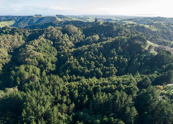
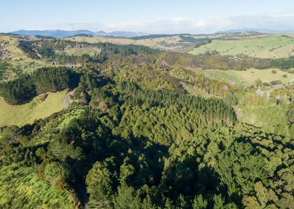
🜁 Buying or selling a farm or forest is an important transaction. Understanding the land use patterns at the location forms a core part of the due diligence process. Our drone technology can provide the full picture.
🜁 Aerial surveying of forests is much less time consuming and far more accurate than paying staff to walk the perimeter, especially with remote blocks and challenging site terrain. We can provide growers with the answers they’re looking for much faster and more cost effectively than is possible with a manual survey.
🜁 Existing maps and imagery may be unsatisfactory by being outdated, too low in resolution, or not detailed enough. Using precision GPS-equipped drones, we can quickly and safely fly over large stands, capturing accurate, up-to-date images of the trees.
🜁 Many owners and their consultants live at a distance from their land. The electronic, up-to-date imagery of the site that we provide allows owners and advisors alike to easily share the digital maps and confer, without having to visit the site.
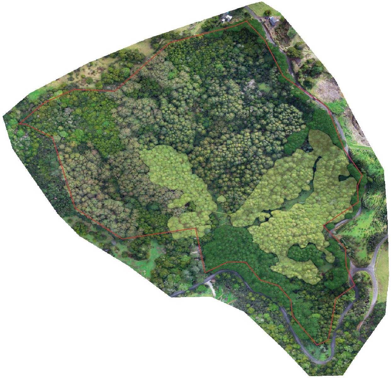
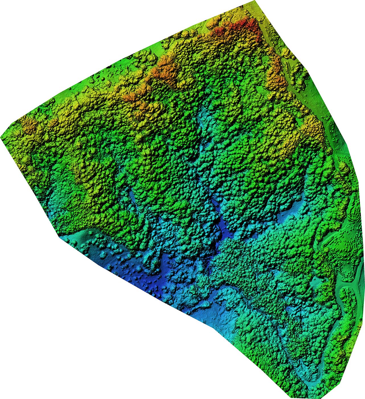
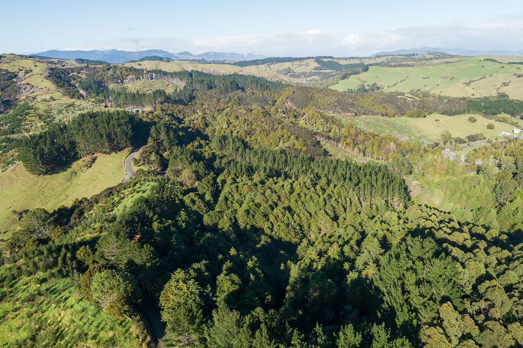
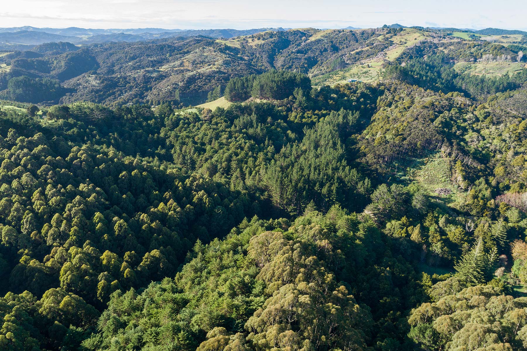
Aerial survey of a forestry block
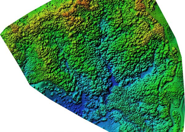
Our client was considering purchasing a remote forestry block in Northland. They needed to know the layout, elevation, location of access tracks, and the number of each type of tree for harvest and emissions trading scheme (ETS) purposes. Access was steep and difficult, and existing imagery was outdated.
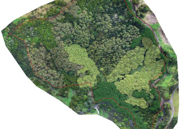
We surveyed the forest using our drone to generate an orthophoto and 3D model. This enabled us to visually identify tree varieties, and create polygons around the Carbon Accounting Area (CAA) in a GIS programme.
The provided map met MPI’s exact Mapping Standard:
+ the correct level of detail,
+ NZTM2000 map projection, and
+ specially created for use in mapping.
We then ran the orthophoto through counting software to obtain an exact count of each tree species tree in the block.