Accurate, repeatable ecological monitoring
Our UAV technology and aerial surveying expertise provide consultant ecologists, conservation and environmental organisations, and universities with the ability to quickly, accurately, and cost-effectively map terrain and vegetation for any area across Northland.
Our process is repeatable, which allows experts to monitor changes in ecosystems and biodiversity due to natural processes, pests and diseases, weed infestation, and human activity.
Read more about our aerial surveying capabilities.
The benefits of conducting aerial environmental surveys with us include:
- Reduced field survey and monitoring costs, especially for areas that are difficult to study on foot. We can survey remote bush, hill, and wetland ecosystems quickly and effectively.
- High resolution imagery captured at low altitude provides comprehensive, objective visual information, for example about vegetation cover and the relative abundance of cover types.
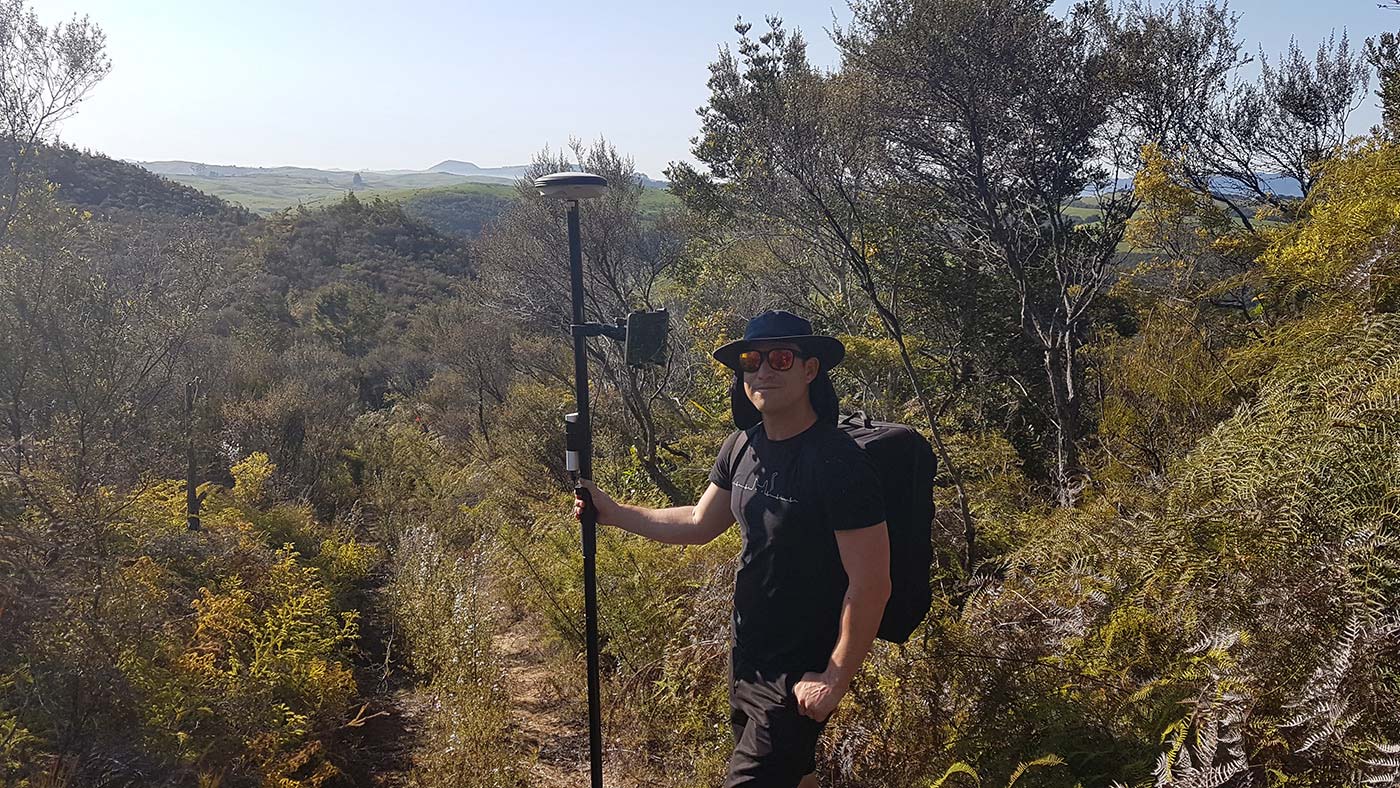
- Accurate GPS ground control aligns UAV imagery with field locations for pin-point accuracy.
- Outputs are available in a range of formats to suit delivery requirements.
- We take care of everything in-house, from the initial consultation, to the survey itself, data processing, and presentation of results.
Mapping a fire-damaged bush reserve by UAV
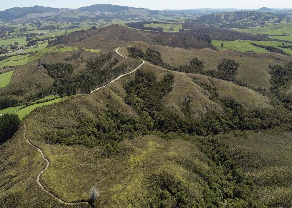
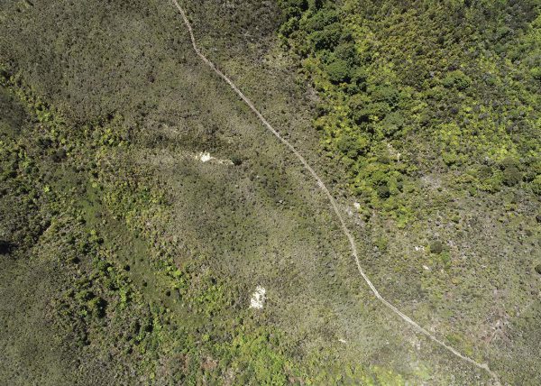
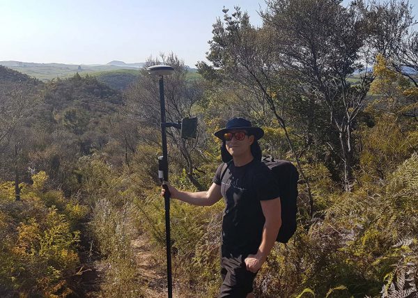
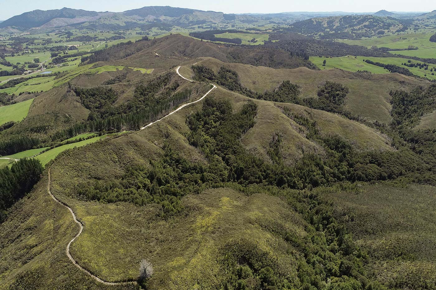
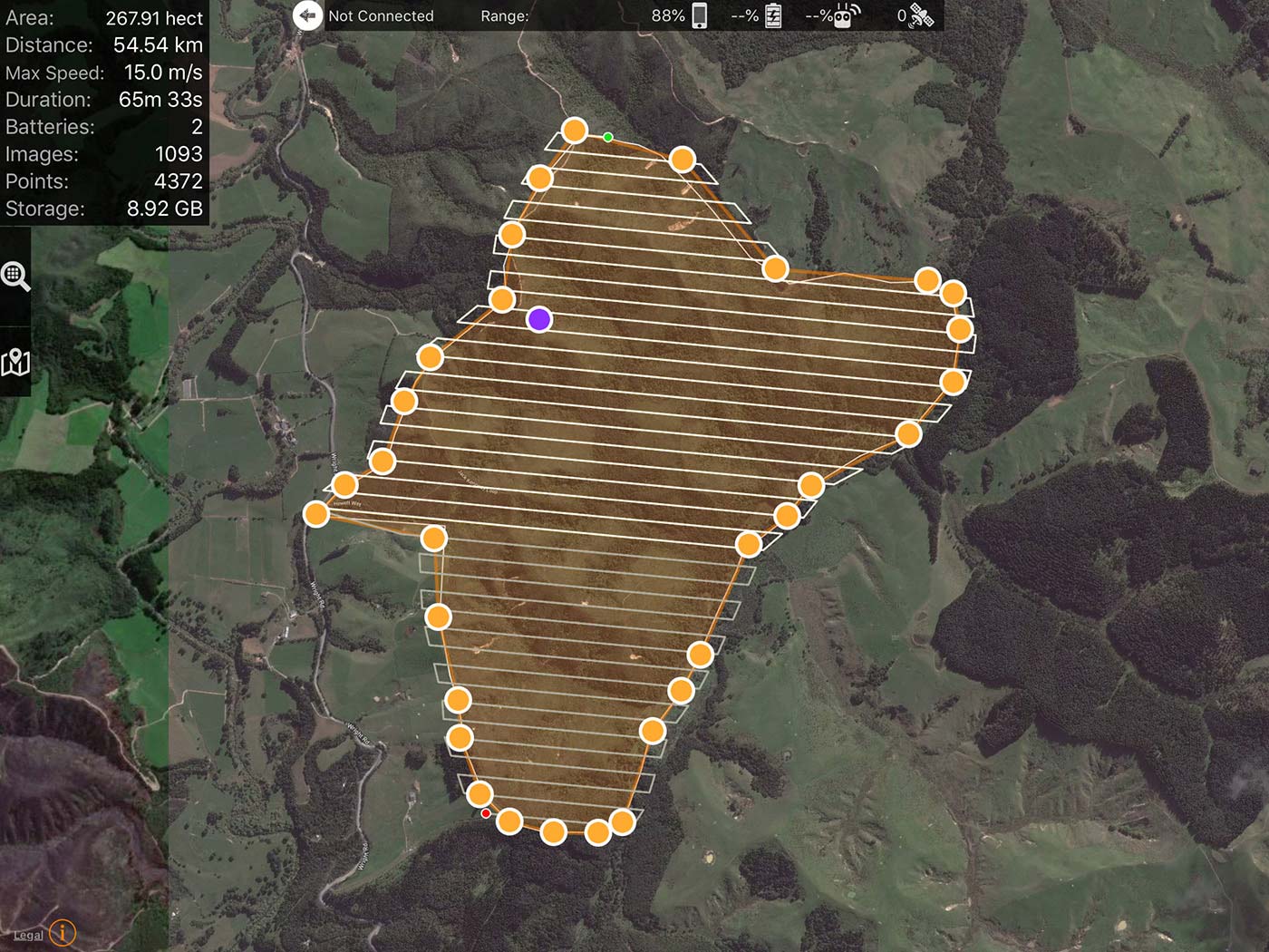
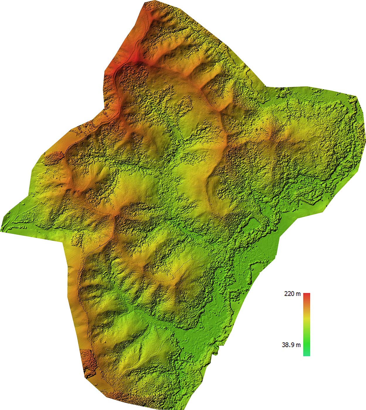
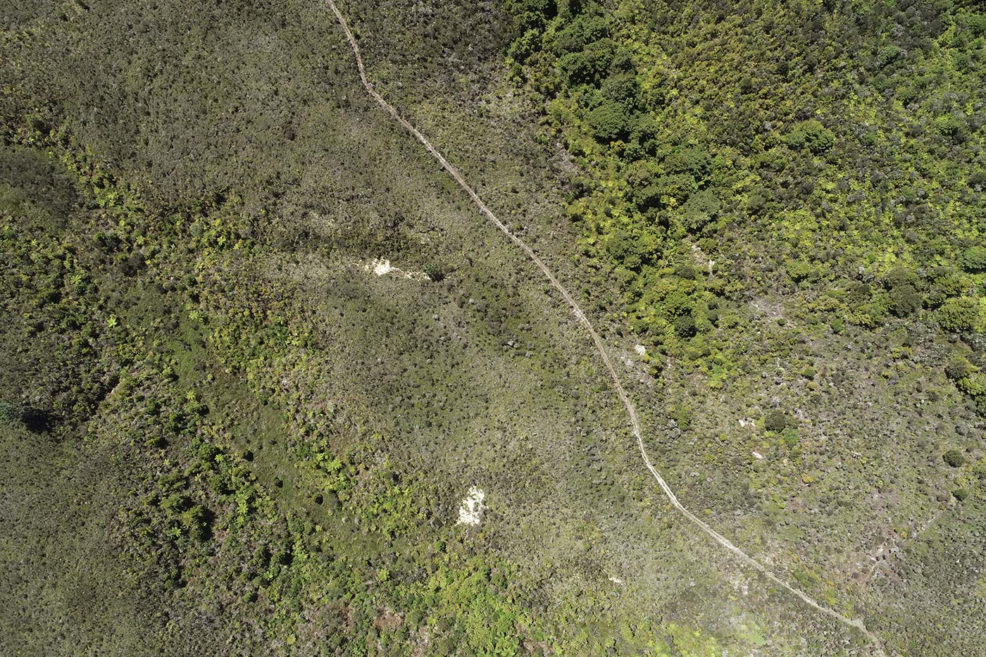
About 20% of a 268 hectare native forest reserve near Pipiwai had been burnt by a fire. Amy Bazeley, an ecological consultant, needed an accurate map to determine the state of the reserve, including to assess weed control, and to monitor recovery from the fire.
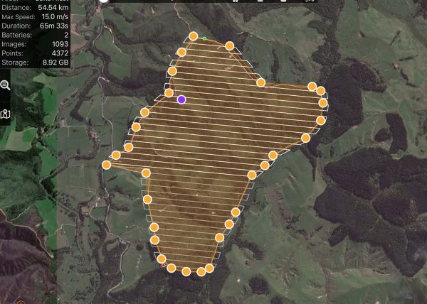
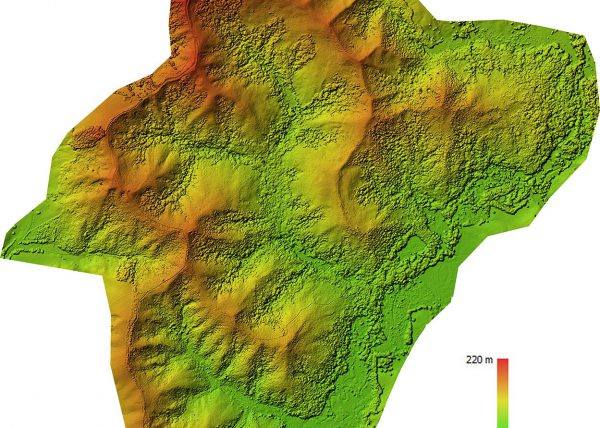
We walked through the reserve, taking precise GPS ground measurements. Then, we made five autonomous drone flights, taking 1100 top-down photos to build up a map and 3D model of the site. Our intrepid drone flew nearly 60 km!