Precise maps and models of significant sites
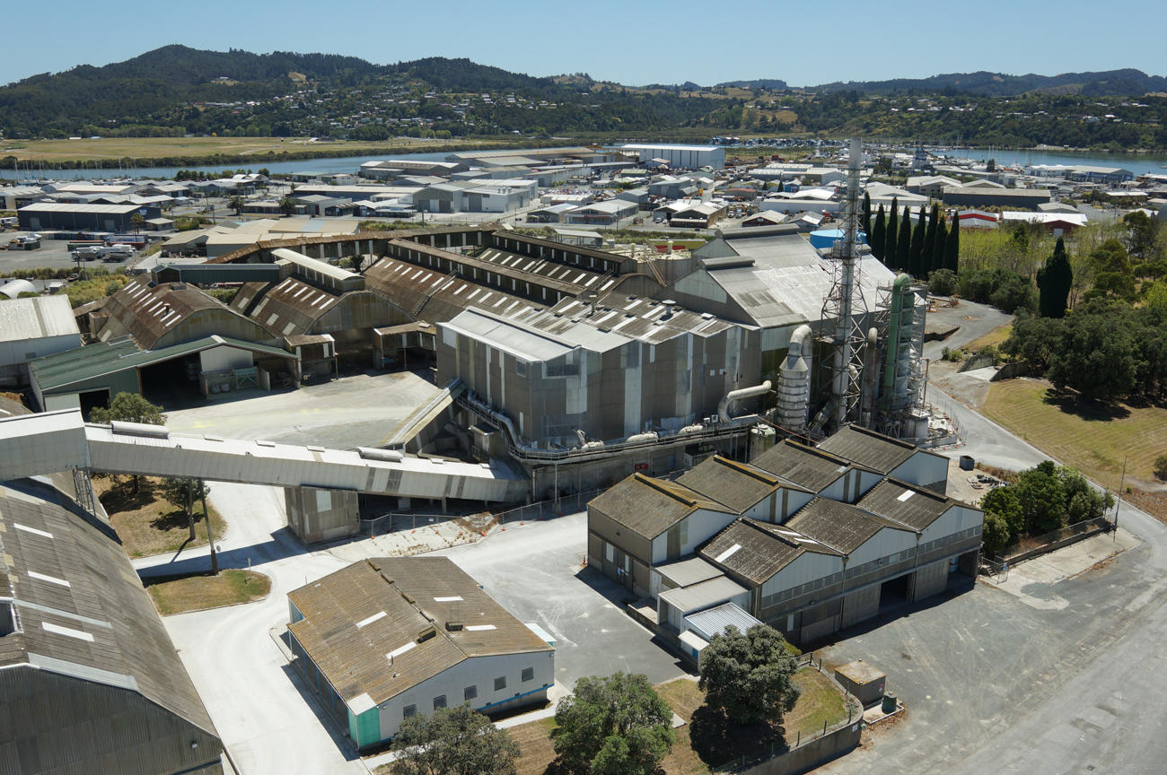
Aerial Vision surveys publicly owned, commercial, and industrial assets. Our drone captures ground features and structural detail with a high degree of accuracy. Using the drone allows us to capture the site safely, without stepping on-site or disturbing work.
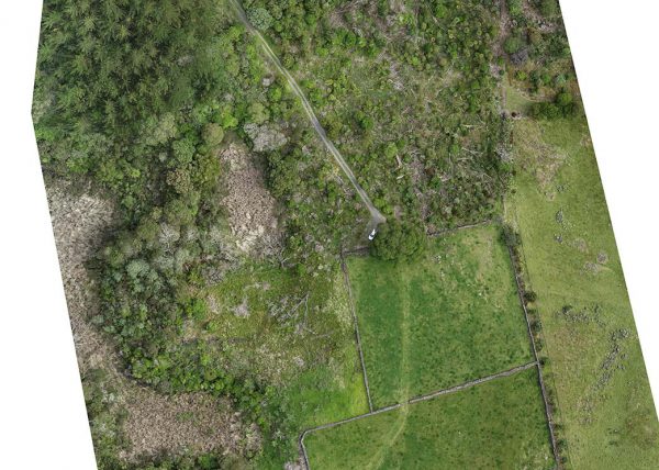
We can provide an accurate record of the current state of an historical or archaeological site prior to development or excavation.
We are able to produce maps in a variety of formats to suit your requirements, and to fit in with your workflow and record management systems.
Aerial Vision is SiteWise Green accredited and holds a CAA part 102 certification. We are accustomed to flying around airports, ports and restricted airspace, and understand the protocols for flight safety. Find out more about our aerial surveying capabilities.
We have professional indemnity, and public and statutory liability insurance.
- We can determine stockpile volumes, or cut and fill volumes for earthmoving projects.
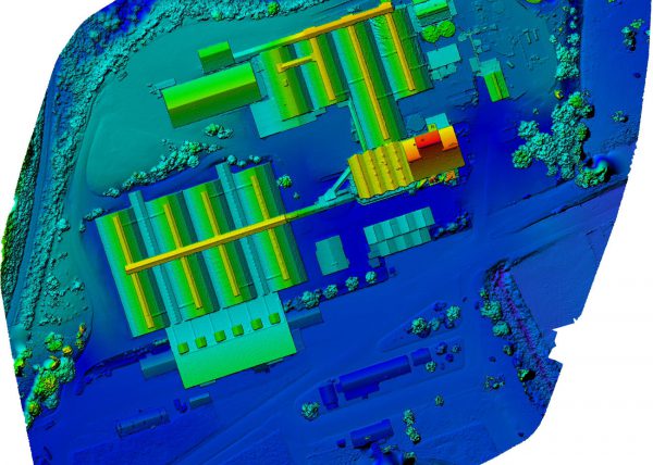
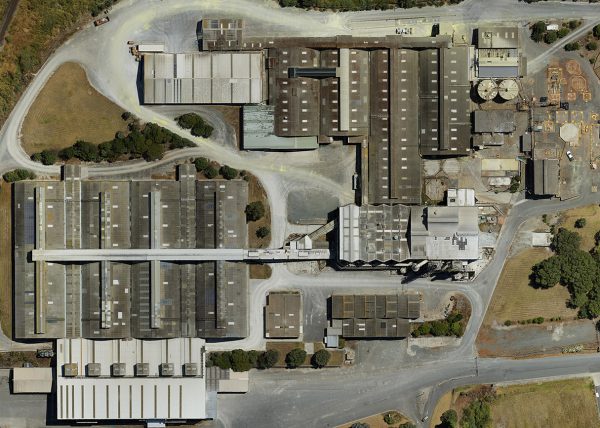
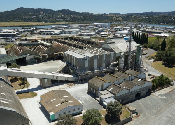
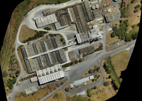
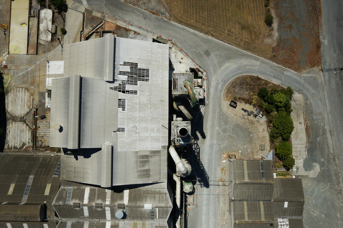
- We can precisely map the current state of commercial assets and infrastructure. For example, we produced photographic plans for the fuel depot at the Marsden Point Oil Refinery and Top Energy’s substations to assist with site health and safety planning.
- A clear, up-to-date map of your site can identify health and safety risks, and enable you to communicate effectively about them. Our aerial map helped the manager of Mapua Avocados communicate about the locations of key parts of the orchard, including hazards, while the property was being developed. This minimised risk and confusion for orchard staff and site visitors.
More about orthophotos
An orthophoto/aerial map is an objective photographic record of the land at an exact point in time. It enables you to use the most current information regarding the land or site for accurate planning, analysis, and decision making.
For example, we helped Kaipara District Council in their transition from hard copy to digital records by providing up-to-date, high resolution aerial imagery of their five cemeteries. As a result, the council had a digital reference for each site, and we enabled them to create a GIS app linking plot information to an accurate, detailed visual map.
An orthophoto shows everything – natural features such as trees, plants, weeds, rivers and lakes; and human-made features like roads, fences, and buildings.
- Because it’s photographic, it’s easy to understand and includes a wealth of visual detail.
- It provides an exact base-line against which you can track changes and progress.
- It’s a digital file that can be stored on computer, tablet or phone, and can be printed.
- It can be referred to multiple times when it’s time to analyse, or plan something on the land.
- It enables you to measure distances and areas without being on site, e.g. how far is that tree from the fenceline? Or, if you have a paddock you want to divide, you can accurately plan where the halfway mark is, measure the new fence distance, and calculate the area of the two new paddocks. All from your computer.
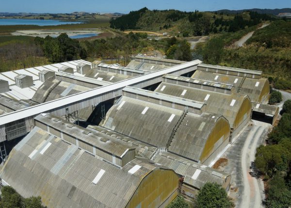
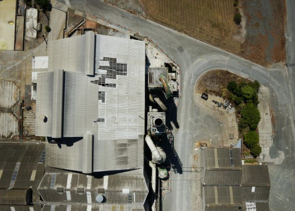
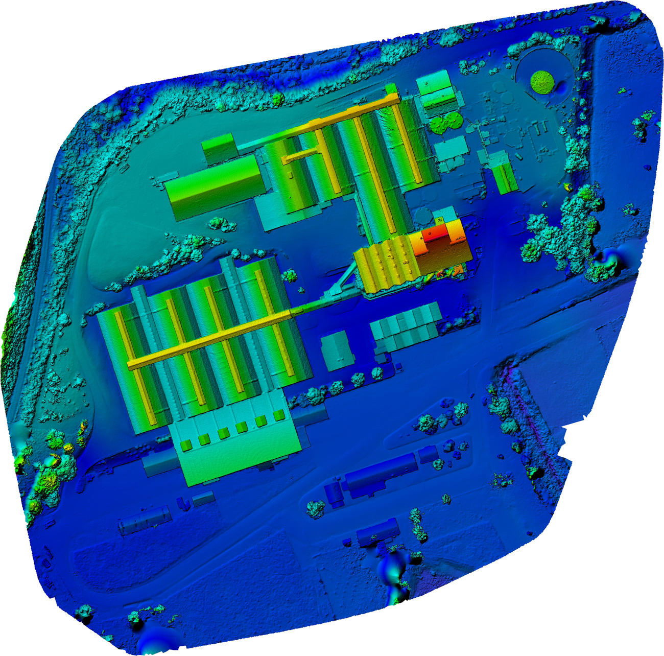
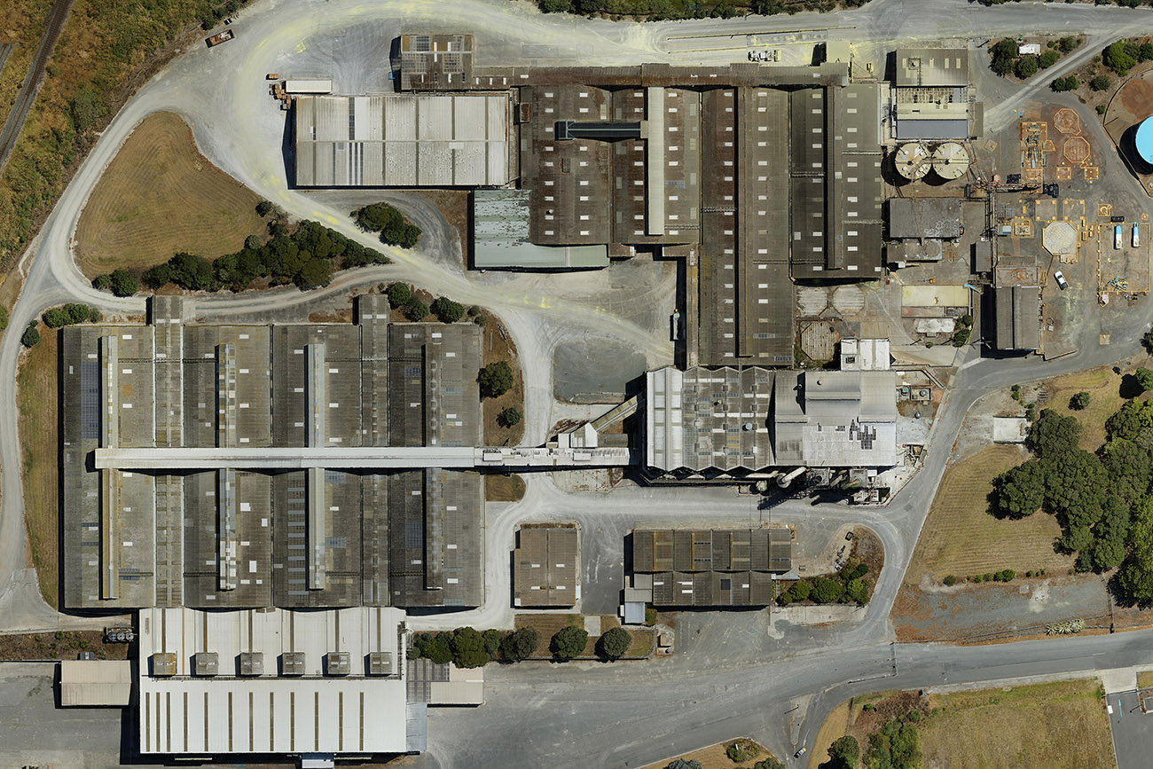
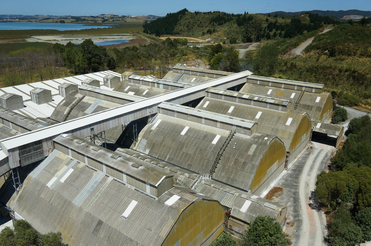
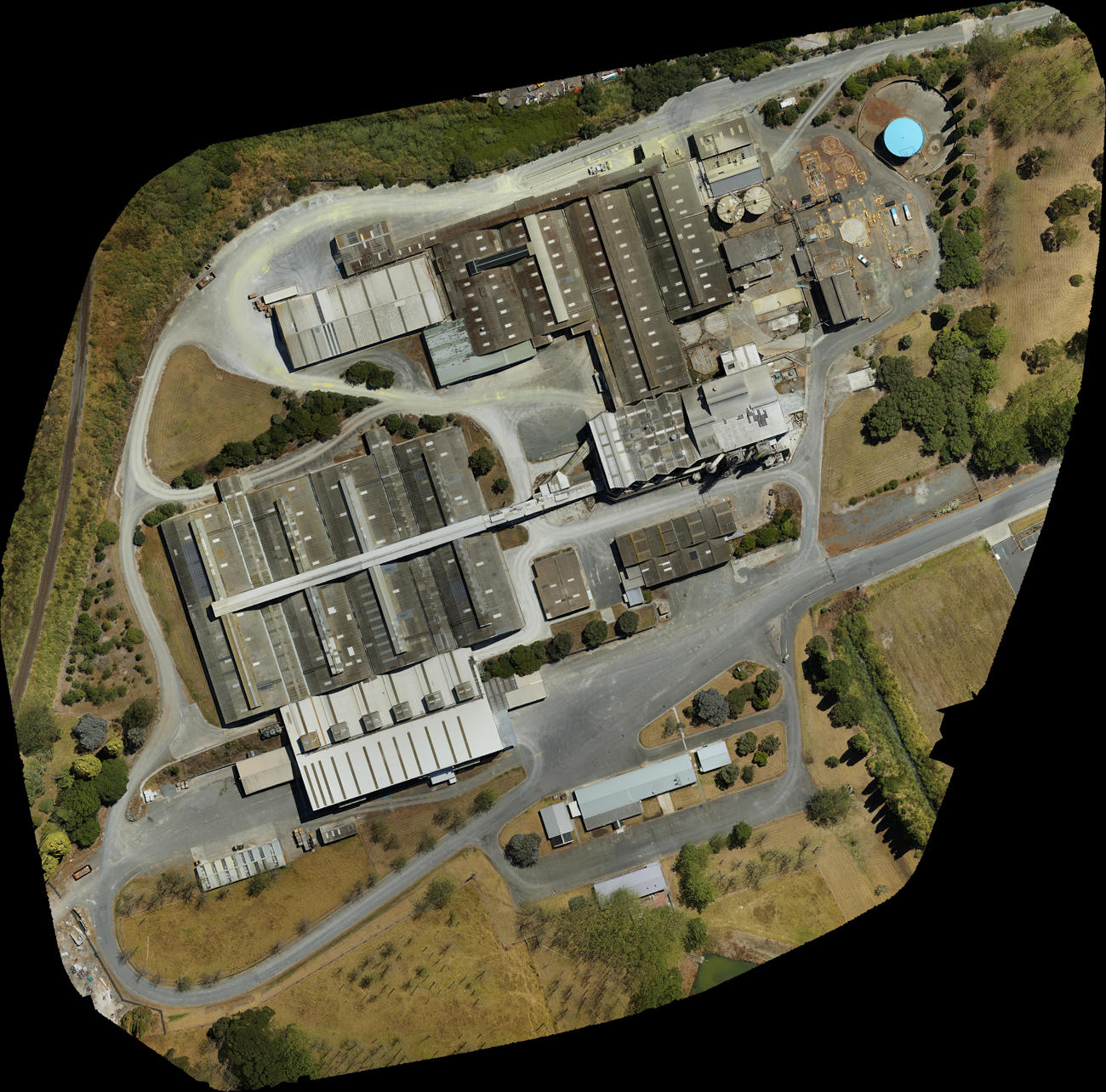
Industrial roof health survey
We carried out an aerial survey of the Ballance building in Whangarei to check roof deterioration. We captured a detailed image of the roof to aid maintenance inspection, and to identify trouble spots. Using our drone solved several problems that would have occurred with manual inspection:
- The old roof was leaking and had asbestos.
- The roof was too difficult to climb up on and install scaffolding.
- The building footprint was large (2 hectares).
- Difficulty in recording trouble spots accurately while on the roof.
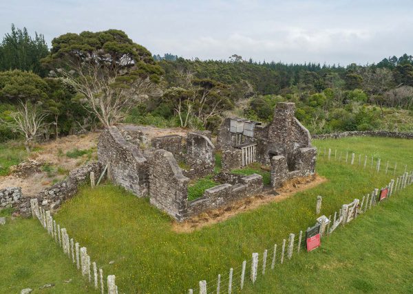
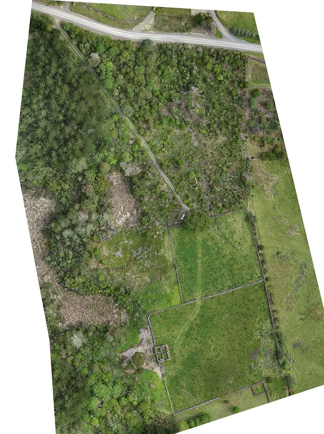
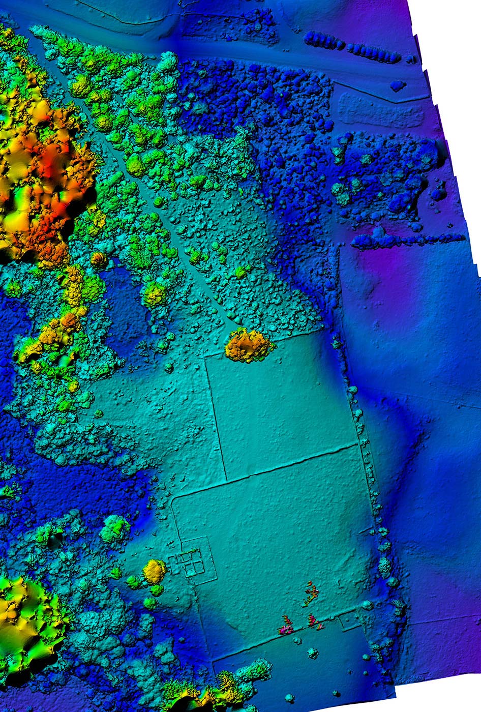
AERIAL SURVEY OF HISTORICAL SITE
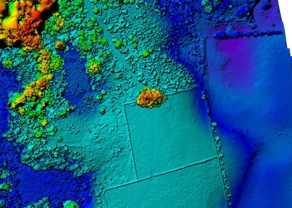
Heritage NZ needed an accurate record of the current state of the Edmonds Ruins historical site, in Kerikeri. We provided an orthophoto and 3D model of the entire site, and oblique photos of the ruins that could be assembled into a separate 3D model.
"10/10 for great service and great quality aerial mapping.” ~ Alex Bell, property lead, Heritage NZ